USEFUL INFORMATION ABOUT ALL CITIES, VILLAGES AND RESORTS IN BULGARIA
Settlement:
Town/Village:
- village of Arzan
- village of Babica
- village of Banishte
- village of Bankya
- town of Batanovci
- village of Baykalsko
- village of Begunovci
- village of Belanica
- village of Berainci
- village of Berende
- village of Bilinci
- village of Blateshnica
- village of Boboraci
- village of Bogdanovdol
- village of Bohova
- village of Bornarevo
- village of Bosnek
- town of Breznik
- village of Breznishki izvor
- village of Brusnik
- village of Businci
- village of Butroinci
- village of Cegrilovci
- village of Chepino
- village of Cherna gora
- village of Chervena mogila
- village of Chukovec
- village of Chuypetlovo
- village of Dalga luka
- village of Debeli lag
- village of Divlya
- village of Divotino
- village of Dokyovci
- village of Dolna dikanya
- village of Dolna melna
- village of Dolna sekirna
- village of Dolna vrabcha
- village of Dolni rakovec
- village of Dragichevo
- village of Dragomirovo
- village of Dren
- village of Drugan
- village of Dushinci
- village of Dzhinchovci
- village of Egalnica
- village of Elovdol
- village of Elovica
- village of Erul
- village of Ezdimirci
- village of Filipovci
- village of Gabrovdol
- village of Galabnik
- village of Garlo
- village of Giginci
- village of Glavanovci
- village of Glogovica
- village of Golemo buchino
- village of Gorna dikanya
- village of Gorna glogovica
- village of Gorna sekirna
- village of Gorna vrabcha
- village of Gorni romanci
- village of Gorochevci
- village of Izvor
- village of Kalishte
- village of Kalotinci
- village of Kasilag
- village of Kladnitsa
- village of Klenovik
- village of Kondofrey
- village of Konska
- village of Kopanica
- village of Kosacha
- village of Kosharevo
- village of Kosharite
- village of Kosturinci
- village of Kovachevci
- village of Kozhinci
- village of Kralev dol
- village of Krasava
- village of Krivonos
- village of Leskovec
- village of Leva reka
- village of Lobosh
- village of Lomnica
- village of Lyalinci
- village of Lyulin
- village of Meshtica
- village of Milkyovci
- village of Miloslavci
- village of Mraketinci
- village of Mramor
- village of Mureno
- village of Murtinci
- village of Nasalevci
- village of Nedelkovo
- village of Negovanci
- village of Nepraznenci
- village of Nikolaevo
- village of Noevci
- village of Odranica
- village of Paramun
- village of Penkyovci
- village of Peshtera
- village of Planinica
- village of Pocarnenci
- village of Priboy
- village of Radibosh
- town of Radomir
- village of Radovo
- village of Raduy
- village of Rakilovci
- village of Rani lug
- village of Rasnik
- village of Rayanci
- village of Razhavec
- village of Rebro
- village of Reyanovci
- village of Rezhanci
- village of Rudarci
- village of Sadovik
- village of Selishten dol
- village of Sirishtnik
- village of Slakovci
- village of Slatino
- village of Slishovci
- village of Smirov dol
- village of Sopica
- village of Stanyovci
- village of Staro selo
- village of Staychovci
- village of Stefanovo
- village of Strezimirovci
- village of Studen izvor
- village of Studena
- village of Svetlya
- town of Tran
- village of Turokovci
- village of Uglyarci
- village of Velinovo
- village of Velkovci
- village of Vidrar
- village of Vidrica
- village of Viskyar
- village of Vitanovci
- village of Vladimir
- village of Vrabcha
- village of Vranya stena
- village of Vukan
- village of Yardzhilovci
- village of Yarlovci
- village of Yaroslavci
- village of Zabel
- village of Zavala
- village of Zelenigrad
- town of Zemen
- village of Zhablyano
- village of Zhedna
- village of Zhitusha
- village of Zidarci
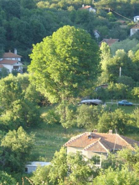
village of Mraketintsi
See it on the map Bulgarian properties in Pernik Region - Mraketinci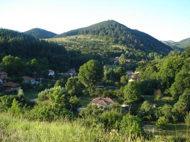
Mraketintsi is a village in West Bulgaria. It is located in Tran municipality, Pernik region.
The village is situated 6 km northwest of the village of Nedelkovo, 10 km southeast of the town of Tran and 37 km northwest of the town of Pernik. The neighboring villages of Paramun and Filipovtsi are respectively 4 km south and 2 km northwest. The capital Sofia is 66 km southeast.
It is situated in mountain region near the flow of Yablanitsa river and its altitude is about 870 m. the climate is temperate and is characterized by clearly expressed four seasons - warm but not hot summer while the winter is very cold. The spring is cool with lots of precipitation and it comes at the end of March and the beginning of April, the fall is warmer.
The permanent population is about 13 people.
The administrative care is taken by the mayor's vice royalty in the village of Nedyalkovo. In the town of Tran are working school, vocational school and kindergarten. Also there are the nearest dentists, GPs, hospital and pharmacy.
Tourism and landmarks
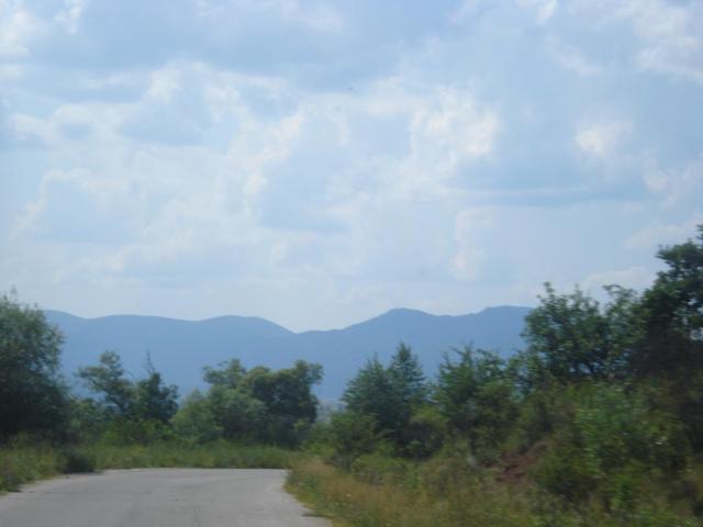
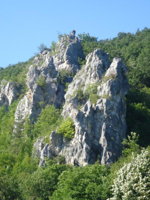
The village of Mraketintsi is starting point for the route to Zdravchi kamak also known as Orlovo gnezdo. It is small and to it leads gravel road that after it becomes narrow forest trail and then at height of about 10 m is the entrance of the cave. From the mountain there is very beautiful view to Dragovski kamak and Zavalska mountain.
Again close to it is Lilyantsi dam that is stocked with fish and very good for fishing. The most interesting landmark in the municipality is Erma river Gorge is a must see.
Another beautiful place that you should go on an excursion to is Vrabcha waterfall (10 km).
Sources: http://bg.wikipedia.org
Photos: http://www.snimka.bg/