USEFUL INFORMATION ABOUT ALL CITIES, VILLAGES AND RESORTS IN BULGARIA
Settlement:
Town/Village:
- village of Aleksandrovo
- village of Badeshte
- village of Bogomilovo
- village of Borilovo
- village of Borushtica
- village of Bozduganovo
- village of Bratya Daskalovi
- village of Bratya Kunchevi
- village of Buzovgrad
- village of Celina
- village of Cenovo
- village of Cherna gora
- town of Chirpan
- village of Dabovo
- village of Dalboki
- village of Dimitrievo
- village of Dolno izvorovo
- village of Dolno novo selo
- village of Elenino
- village of Elhovo
- village of Enina
- village of Gabarevo
- town of Galabovo
- village of Gita
- village of Golyam dol
- village of Golyamo Dryanovo
- village of Gorno Belevo
- village of Gorno Botevo
- village of Gorno novo selo
- village of Granit
- town of Gurkovo
- village of Han Asparuhovo
- village of Kalitinovo
- village of Kazanka
- town of Kazanlak
- village of Kirilovo
- village of Kolarovo
- village of Kolena
- village of Kolyu Marinovo
- village of Koprinka
- village of Kovachevo
- village of Kran
- village of Lyulyak
- town of Maglizh
- village of Malko Тranovo
- village of Medovo
- village of Mogilovo
- village of Naydenovo
- town of Nikolaevo
- village of Novo selo
- village of Orizovo
- village of Partizanin
- village of Pastren
- town of Pavel banya
- village of Pchelinovo
- village of Plodovitovo
- village of Pomoshtnik
- town of Radnevo
- village of Rakitnitsa
- village of Razhena
- village of Risimanovo
- village of Rumanya
- village of Rupkite
- village of Selce
- village of Sheynovo
- town of Shipka
- village of Sredno gradishte
- resort Starozagorski bani
- village of Sulica
- village of Tazha
- village of Tulovo
- village of Turiya
- village of Velikovo
- village of Veren
- village of Viden
- village of Vinarovo
- village of Yasenovo
- village of Yavorovo
- village of Yulievo
- village of Zagore
- village of Zemlen
- village of Zlatna livada
The village of Gita
See it on the map Bulgarian properties in Stara Zagora Region - Gita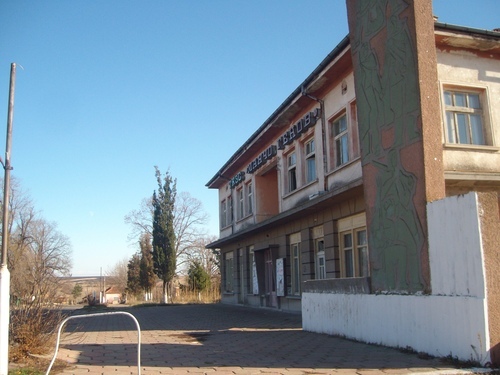

Gita is a village in southern Bulgaria. It is located in the municipality of Chirpan, Stara Zagora Region.
The village is about 13 km east of the town of Chirpan, 38 km southwest of the regional centre Stara Zagora and about 209 km southeast of the capital Sofia city.
The village is located in the Upper Thracian Plain at altitude about 180-200 metres. In the north of the village lie the Chirpan heights and further north lies Surnena Gora mountain - the most eastern part of the Sredna Gora mountains. About 6-7 km away from the village runs the Maritsa River.
The population of the village is about 760 people.
The relief is slightly indented by semi hilly and plain areas through which two rivers run – the Rivers Arka and Kanuta.
The climate is temperate-continental which determines the mild winter and the hot summer.
The village of Gita has good infrastructure – the roads are in good condition, the streets are paved. The village has fully developed electricity, water supply and sewerage systems. All mobile operators have coverage. There is regular bus transport to the village.
The village is located in the close proximity of the place where two highways with international importance intersect. Those are Trakia Highway (Sofia city - Burgas) and Maritsa Highway (Sofia city - Svilengrad). The investment in their construction is one of the most important factors for the future economic development of the municipality of Chirpan and respectively – of the village of Gita.
Gita has a grocery store, a primary school, as well as a health centre after an overhaul. The medical care is provided by one GP. The nearest hospital and kindergarten are located in the town of Chirpan.
LANDMARKS
The historical finds in the area of the village indicate that lands in close proximity of the village have been inhabited since ancient times. Throughout the area there are plenty of small hills(mounds), the most famous of which are Dekova mound, the Three mounds, Kyutchuk mound and Vasileva mound.
Remains of an old Roman construction, consisting of different sized pieces of crushed, flat, marble plates are found in the same area, at about three km northeast of the village, near the old Roman “Trayanov” road (most probably the road was built during the reign of the Roman Emperor Trayan – 98 – 117 AD).
At about six km northwest of the village lies the archaeological site Karasura – a unique site with historical remains from prehistoric times (4-5 thousand BC) until the Middle Ages (13th century)
South of the village, about 7 km away, lies Merichleri Spa resort, famous for its healing water.
Source: http://mdm-baltasar.blogspot.com , http://bg.wikipedia.org
Photos: Internet