USEFUL INFORMATION ABOUT ALL CITIES, VILLAGES AND RESORTS IN BULGARIA
Settlement:
Town/Village:
- village of Aleksandrovo
- village of Balkan
- village of Belopolci
- village of Biser
- village of Borislavci
- village of Brod
- village of Bryagovo
- village of Careva polyana
- village of Cherepovo
- village of Chernodab
- village of Dimitrovche
- town of Dimitrovgrad
- village of Dobrich
- village of Dobroselec
- village of Drabishna
- village of Gorski izvor
- town of Harmanli
- village of Hlyabovo
- town of Ivaylovgrad
- village of Kapitan petko voyvoda
- village of Kapitan-andreevo
- village of Kasnakovo
- village of Knizhovnik
- village of Krepost
- village of Lozen
- town of Lyubimec
- town of Madzharovo
- village of Malko gradishte
- village of Mandrica
- town of Merichleri
- village of Mezek
- village of Mineralni bani
- village of Oryahovo
- village of Plevun
- village of Polyanovo
- village of Radievo
- village of Radovec
- village of Rogozinovo
- town of Simeonovgrad
- village of Skobelevo
- village of Srem
- village of Stalevo
- village of Stambolovo
- village of Studena
- village of Susam
- town of Svilengrad
- village of Svirachi
- village of Svirkovo
- town of Topolovgrad
- village of Troyan
- village of Ustrem
- village of Valche pole
- village of Voyvodovo
- village of Yabalkovo
- village of Yerusalimovo
- village of Zhalti bryag
village of Dobroselets
See it on the map Bulgarian properties in Haskovo Region - Dobroselec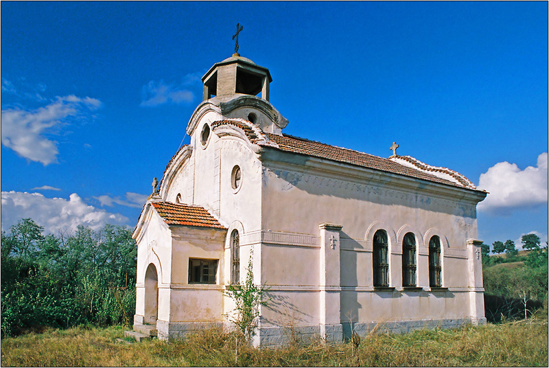
Dobroselets is a village in Southern Bulgaria, ot is part of Topolovgrad municipality, Haskovo region.
It is located in the north slope of Sakar mountain at about 10 km north of Topolovgrad, 28 km west of Elhovo and 55 km southwest of Yambol.
The population is about 130 people.
The terrain in the area is a mix between a low flat and hills. The climate is temperate-continental with a strong Mediterranean influence. Summer here is hot and dry and winters - mild. In winter there are periods of heavy snow, low temperatures and large snowfalls. Spring is characterized by a rapid increase in temperature. Fall for its most time is dry and relatively warm.
The altitude is 191 m.
In the village there is a city hall, a church, a post office, shops and cafe, mobile network coverage.
Regular bus transport connects the village with other settlements and towns.
The closest kindergarten, school, pharmacy and hospital are in town of Topolovgrad.
Near to the village has been built a photovoltaic power plant for producing electricity.
Landmarks
In the lands of Dobroselets is the cave Kara Kolyovi dupki. It is 33 m long.
Roman fortress "Kaleto" and a roman road are situated 2.6 km southeast of the center of Dobroselets.
Nearby there are also remains of Roman baths, Thracian mounds, preserved tombs of the First Bulgarian Empire, Celtic cemeteries and other historical values.
In the land, below the village and its surroundings, is the largest and compact gold deposit in Bulgaria.
Sources: http://bg.wikipedia.org