Medieval fortress "Monyak"

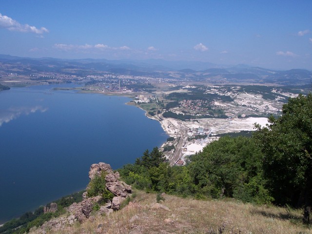


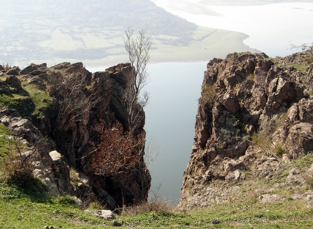
Monyak fortress /also called "Mneakos"/ is one of the largest and high located fortresses in the Rhodope mountains near the village of Shiroko pole, Kardzhali Region, on the bank of Studen Kladenets Dam. It is located about 2 km south of the village of Shiroko pole, 11 km east of Kardzhali, 104 km south-east of Plovdiv and approximately 251 km in the same direction of the capital Sofia city.
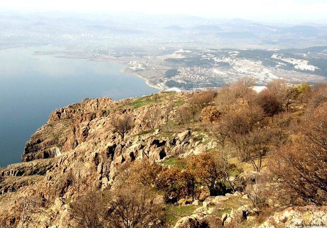
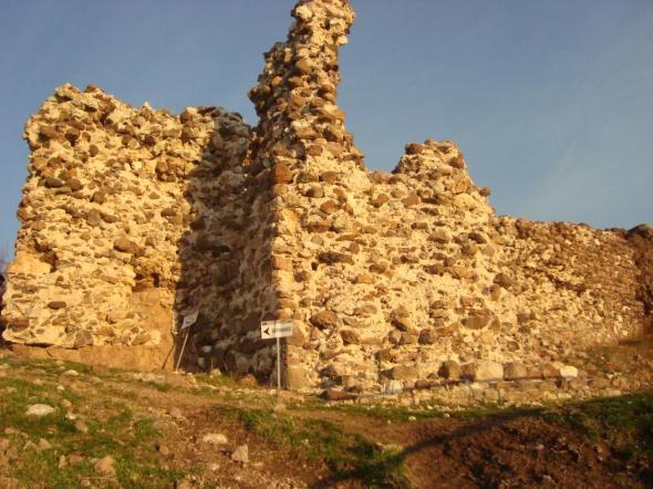
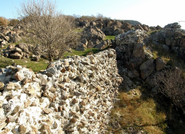
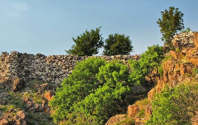
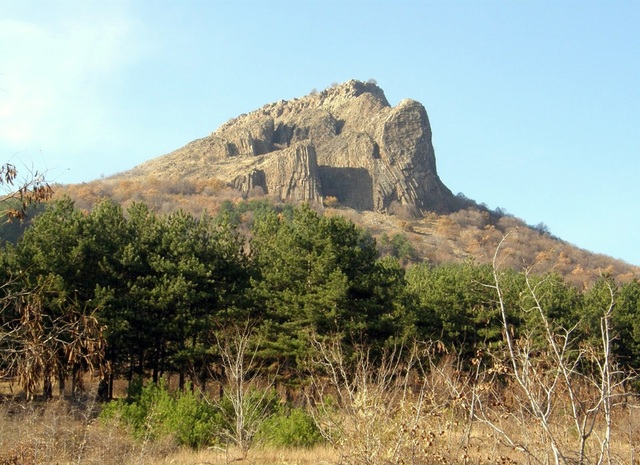
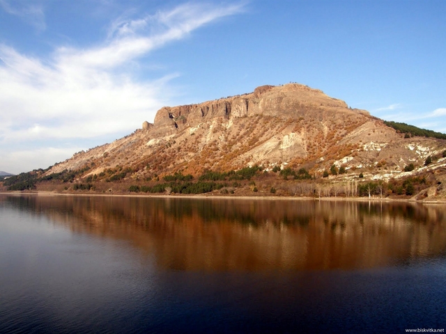
It was built in XII - XIII century and with its 50 ha Monyak is one of the largest fortresses in the Rhodopes. Its remains are situated an a rocky hill called Shesta krepost /586 m/. Its outer wall is built of stones tightly soldered with plaster and encircles the hill from the north.
architecture
The entrance is situated on the western side and has a tower on both sides. The northern part is a trapezoidal solid bastion and the southern had a few floors and is today preserved to a height of 7.80 m. The wall continues south reaching a 50 m high impassable rocky cliff.
A citadel with solid trapezoidal bastion walls occupies the highest soutern part of the highland. During research works several buildings were localised:
- A building with quadrant footprint situated in the inner part of the citadel.
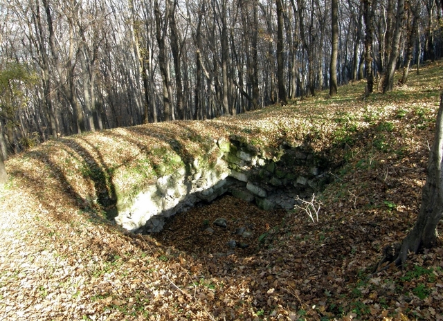
- A representative building located west under the citadel. It was at least two-storey and the lower floor was dug into the rock. Four quadrent pillars carry the upper floor which floor is even with the rocks. It can be stated for sure that this was a storage reservoir with a civil building under it.
- Second building located in the axis at the entrance of the outer wall. It is of the kind described above. The ground floor is dug into the rock and the large amount of pottery discovered there indicates that this floor used to be a food warehouse. More than 20 utensils were found with pitchers and jugs prevailing. The entrance is from the west, flanked by two rectangular towers.
history
The first evidence of the fortress belong to the Third Crusade /1189-1192/. On their way to Palestine the western knights conquered Monyak, which was an important Byzantine stronghold in the region at that time. In the last decade of the XII century and the passage of the Crusader army, Monyak was under Byzantine control again. Knights of the Cross returned to the important fortress in the valley of the river Arda after the Fourth Crusade and the conquest of Constantinople in April 1204 A garrison was probably placed in Monyak then.
Monyak is mentioned in the writings of George Akropolit and Theodore Skutariot in the XIII century. The chronicler and marshal Geoffroy Villehardouin says it was there that the Latins learned of the death of Emperor Baudouin Flanders. The Baron Meeting which elects Henry for emperor of the Latin Empire was conducted there. During the XIII and XIV centuries Monyak as well as the whole Ahridos area, was the border territory between the Second Bulgarian Kingdom and the Byzantine Empire. The fort's strategic location made it the residence of the governors of Ahridos, including several famous Byzantine generals.
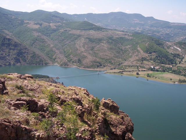
Monyak fortress has a direct visual connection with the Vishegrad fortress, situated on the opposite bank of Studen kladenets dam and the hill reveals a splendid view to the mountains, the valleys, hills and the dam itself.
transport
The village of Shiroko pole is easily reacheble since it is located on the railroad line Haskovo - Kardzhali. From the village to the fort you will find a well-formed route, marked with a special sign. The terrain is steep, almost vertical in places.
accomodation
Several hotels, villas and guest houses, holiday homes and restaurants are available for tourists in the town of Kardzhali.
Sources: http://ivoso.blog.bg, http://tourism.kardjali.bg, http://biskvitka.net, http://www.nasamnatam.com
Photos: http://www.nasamnatam.com, http://biskvitka.net, http://bg.wikipedia.org, http://www.panoramio.com

Chuprene Biosphere Reserve
The reserve is one of the largest biosphere reserves in Bulgaria. It is established in 1973 to preserve the northern coniferous forests of Bulgaria. In 1977 it was included in the list of biosphere reserves under the program "Man and Biosphere".
See on the map
Water Holes Cave
Water Holes Cave is located in Apriltsi Municipality, within the Central Balkan National Park on the northern slope of the massif of Botev Mount.
See on the map
Albotin rock monastery
Albotin monastery is an inactive Medieval rock monastery included in Vidin diocese.
See on the map
Uzana - the geographic center of Bulgaria
Uzana - the heart of the Balkans. In its embrace, the mountains has kept this extraordinary place where you can fully take charge with power and hours to enjoy its grandeur and beauty of nature.Far from the urban vanity you will find abundance of colors and shades, serenity and peace of mind. Here the warbling of the birds and the whisper of wild grasslands will put a spell on you forever.

Chervenitsa - geological phenomena over the village of Kunino
The natural phenomenon Chervenitsa is a molded boulder, rising more than 150 m above the terrace of the river Iskar in village of Kunino. It is located about 46 km east of Vratsa and approximately 120 km northeast of Sofia.
See on the map
The museum of salt
A unique museum in the whole Eastern Europe dedicated to the production of salt by solar evaporation of sea water, Pomorie
See on the map
Lopushanski monastery "Sv. Yoan Predtecha"
The Lopushanski monastery is located in the Balkan Mountain in the valley of Dalgodelska Ogosta river. It is operational and consists of a church, residential and farm buildings and a white stone fountain, all surrounded by a stone wall.
See on the map
Taukliman Reserve
Natural Reserve Taukliman typical landslide with length of about 4 km, formed between the edge of the Dobrudzhansko plateau and the coast.

Basilica Sveta Sofia - Sofia city
The Early Christian basilica Sveta Sofia is an active Orthodox church in the center of Sofia city. The church was probably built in the early VI century on the ruins of early Christian tombs from II - IV century and the ruins of two earlier churches from IV-V century. It is located among the necropolis of the ancient Serdica.
See on the map
Vakarelski monastery "St Petka"
Vakarelski monastery "St Petka" was found in XX century and now it is working occasionally. It was functioning as nunnery.
See on the map
"The Womb" cave
A unique Thracian temple near the village of Nenkovo, Kardzhali Region
See on the map
Thracian sanctuary "Gluhite kamani"
The megalithic complex "Gluhite kamani" is one of the largest Thracian sanctuaries since BC, whose strength continues to act today to anyone who visits it.
See on the map
Krivus Fortress
A medieval fortress located on a picturesque cliff above Arda River near the village of Bashevo, Kardzhali Region
See on the map
"St. Konstantin and Elena" monastery near Ladzha quarter, Ivaylovgrad
The monastery of Lazdha or Ivaylovrad monastery "St. Konstantin and Elena" is situated close to Ladzha quarter in the town of Ivaylovgrad
See on the map
Rakovitsa monastery Sveta Troitsa
Rakovitsa monastery Sveta Troitsa was was found in X-XI century and during the Middle Ages was an important literary and cultural center in Bdin area.
See on the map
Roman tomb - town of Hisarya
The Hisar tomb is a late Roman family tomb built in the second half of the IV-th century.
See on the map
Elenska basilica
Elenska basilica is early Christian temple that is preserved to nowadays and is situated in proximity to the town of Pirdop
See on the map
"St. Theodor Tyron and Theodor Stratilat" church
A unique monument of culture with extremely precious frescoes and icons included in UNESCO's list with the World Cultural Heritage, village of Dobarsko, Blagoevgrad Region
See on the map
Ovech Fortress
One of the oldest fortresses in Bulgaria located on a high mountain plateau above the town of Provadiya
See on the map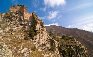
Momina kula Fort
Late ancient and medieval fortress in the Pirin mountain part of Mesta River in the settlement of the village of Kremen
See on the map