Roman Fortress Sexaginta Prista
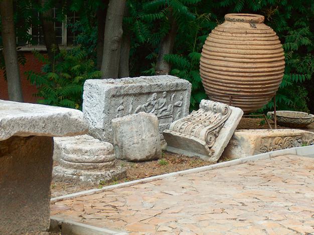
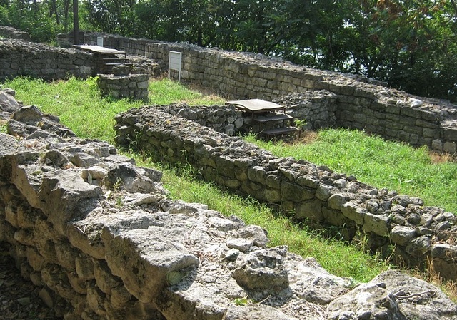
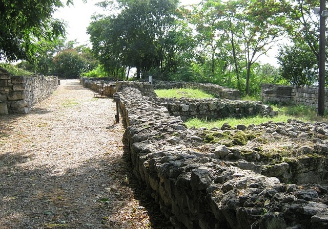
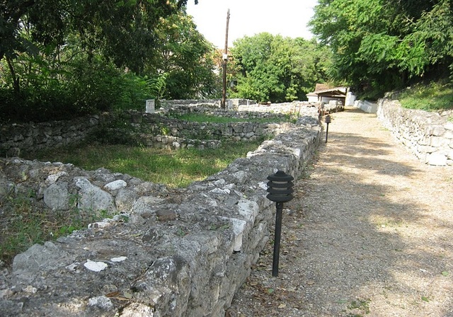
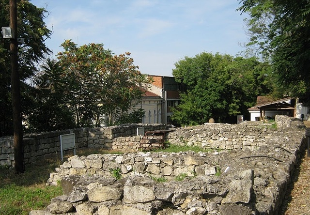

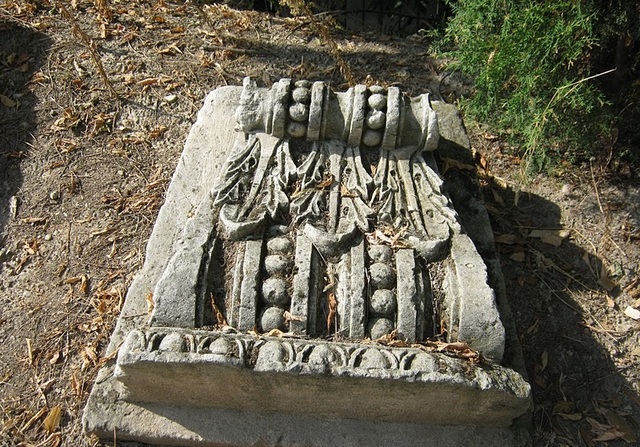

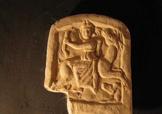


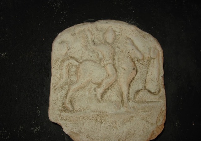
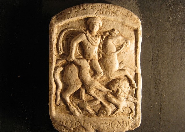
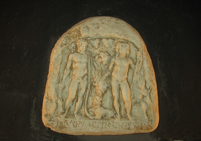
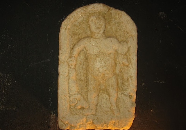
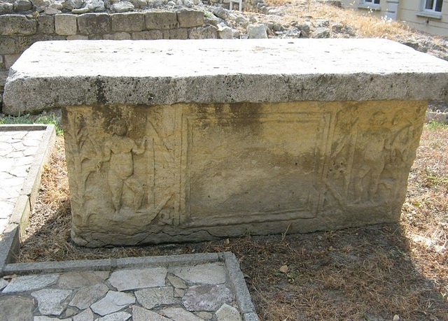
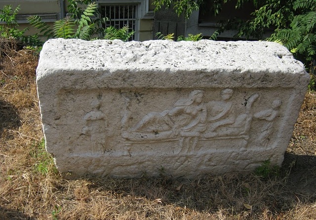
The Roman fortress Sexaginta Prista is located in the town of Ruse, on the bank of the Danube River, 195 km north-west of Varna and 311 km north-east of the capital Sofia city.
The fortress, whose translated name means "Port of the sixty ships", represents an open exposition and is a part of the Regional Historical Museum of Ruse.
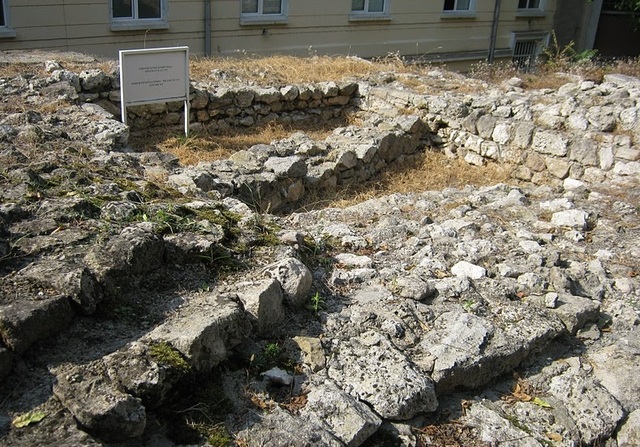
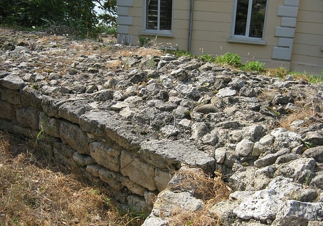
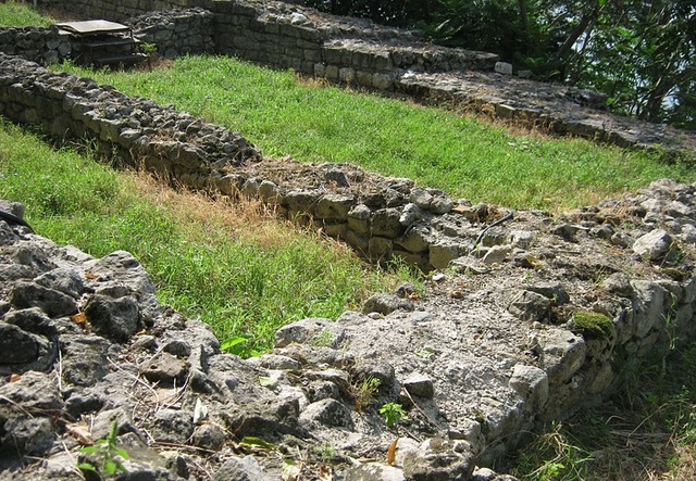
The preserved north walls of the fortress can still be seen, as well as a square tower, a sarcophagus and numerous stone fragments.
The monument dates back from the Roman times, when a Roman castle was built on the ruins of an ancient Thracian settlement. The castle is first mentioned in the writings of the ancient geographer Claudius Ptolemy and the guidebook of the Emperor Antoninus. Making an analogy of the name of the castle with a military port in Italy from Trayan's time, which means "one hundred cameras", it can be assumed that Sexaginta Prista had 60 fortified barriers, which made it a place with key strategic functions.
The first evidence of the castle comes from the writings of the ancient geographer Claudius Ptolemy, who mentions its existence. Sexantapristis is also mentioned in the guidebook of the emperor Antoninus Pius. During excavations conducted in 2006 were found the remains of a Roman military headquarter, probably used in the first quarter of the IV century until the first decade of the V century. The dating was done on the basis of the found coins and pottery. Thirty steps leading to the fortified stone tunnel used during the Ottoman era were also found there.
The castle "Sexaginta Prista" died under the blows of the Avars and Slavs at the end of VI and the beginning of VII century like many castles along the right bank of the Lower Danube River. Later, during the IX-X century the medieval town of Ruse emerged on the ruins of the fortress. The discovery of a Christian tomb and bones of other individuals allowed the hypothetical assumption that one of the cemeteries of Ruse used to be here between XII-XV century.
TRANSPORT AND ACCOMODATION
The fortress Sexaginta Prista is easily reached as it is located in the town of Ruse. It is located on 2 Tsar Kaloyan Str and is open to visitors every day from 8:30 till 17:30 / except Monday and Sunday /.
Ruse offers excellent accommodation conditions for tourists - several hotels, guest houses, restaurants and afes are available for tourists.
Sources: http://bulgaria-tourismbg.com, http://bg.wikipedia.org
Photos: http://tsenko.blogspot.com

Chuprene Biosphere Reserve
The reserve is one of the largest biosphere reserves in Bulgaria. It is established in 1973 to preserve the northern coniferous forests of Bulgaria. In 1977 it was included in the list of biosphere reserves under the program "Man and Biosphere".
See on the map
Water Holes Cave
Water Holes Cave is located in Apriltsi Municipality, within the Central Balkan National Park on the northern slope of the massif of Botev Mount.
See on the map
Albotin rock monastery
Albotin monastery is an inactive Medieval rock monastery included in Vidin diocese.
See on the map
Uzana - the geographic center of Bulgaria
Uzana - the heart of the Balkans. In its embrace, the mountains has kept this extraordinary place where you can fully take charge with power and hours to enjoy its grandeur and beauty of nature.Far from the urban vanity you will find abundance of colors and shades, serenity and peace of mind. Here the warbling of the birds and the whisper of wild grasslands will put a spell on you forever.

Chervenitsa - geological phenomena over the village of Kunino
The natural phenomenon Chervenitsa is a molded boulder, rising more than 150 m above the terrace of the river Iskar in village of Kunino. It is located about 46 km east of Vratsa and approximately 120 km northeast of Sofia.
See on the map
The museum of salt
A unique museum in the whole Eastern Europe dedicated to the production of salt by solar evaporation of sea water, Pomorie
See on the map
Lopushanski monastery "Sv. Yoan Predtecha"
The Lopushanski monastery is located in the Balkan Mountain in the valley of Dalgodelska Ogosta river. It is operational and consists of a church, residential and farm buildings and a white stone fountain, all surrounded by a stone wall.
See on the map
Taukliman Reserve
Natural Reserve Taukliman typical landslide with length of about 4 km, formed between the edge of the Dobrudzhansko plateau and the coast.

Basilica Sveta Sofia - Sofia city
The Early Christian basilica Sveta Sofia is an active Orthodox church in the center of Sofia city. The church was probably built in the early VI century on the ruins of early Christian tombs from II - IV century and the ruins of two earlier churches from IV-V century. It is located among the necropolis of the ancient Serdica.
See on the map
Medieval fortress "Monyak"
"Monyak" fortress is one of the largest and high located fortresses in the Rhodopes near the village of Shiroko pole, Kardzhali Region
See on the map
Vakarelski monastery "St Petka"
Vakarelski monastery "St Petka" was found in XX century and now it is working occasionally. It was functioning as nunnery.
See on the map
"The Womb" cave
A unique Thracian temple near the village of Nenkovo, Kardzhali Region
See on the map
Thracian sanctuary "Gluhite kamani"
The megalithic complex "Gluhite kamani" is one of the largest Thracian sanctuaries since BC, whose strength continues to act today to anyone who visits it.
See on the map
Krivus Fortress
A medieval fortress located on a picturesque cliff above Arda River near the village of Bashevo, Kardzhali Region
See on the map
"St. Konstantin and Elena" monastery near Ladzha quarter, Ivaylovgrad
The monastery of Lazdha or Ivaylovrad monastery "St. Konstantin and Elena" is situated close to Ladzha quarter in the town of Ivaylovgrad
See on the map
Rakovitsa monastery Sveta Troitsa
Rakovitsa monastery Sveta Troitsa was was found in X-XI century and during the Middle Ages was an important literary and cultural center in Bdin area.
See on the map
Roman tomb - town of Hisarya
The Hisar tomb is a late Roman family tomb built in the second half of the IV-th century.
See on the map
Elenska basilica
Elenska basilica is early Christian temple that is preserved to nowadays and is situated in proximity to the town of Pirdop
See on the map
"St. Theodor Tyron and Theodor Stratilat" church
A unique monument of culture with extremely precious frescoes and icons included in UNESCO's list with the World Cultural Heritage, village of Dobarsko, Blagoevgrad Region
See on the map
Ovech Fortress
One of the oldest fortresses in Bulgaria located on a high mountain plateau above the town of Provadiya
See on the map