The Rock window
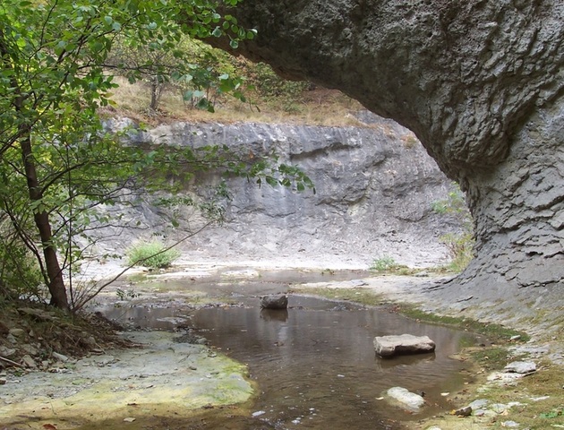


The Rock window is a natural phenomenon located near the village of Kostino, 16 km norht-west of the town of Kardzhali.
It occupies area of 2 ha in the area of the wide Kostinski dol, in the close proximity of the villages of Krushka and Golyama bara.
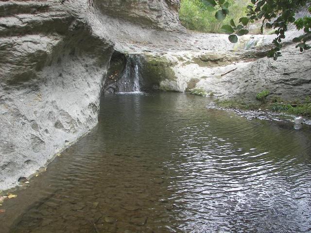
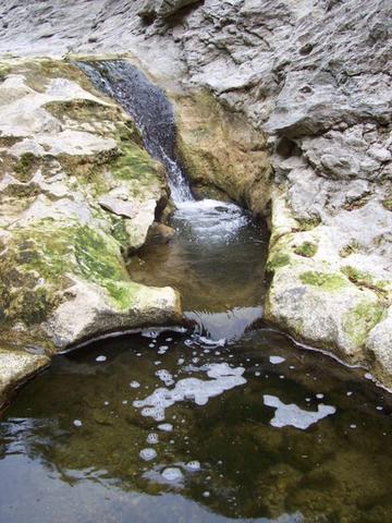
The rock window represents a unique natural phenomenon with the shape of a hanging bridge, supported by two columns with cut from all the sides canvas . The canvas is white, made by white limestone and it rises above the columns of the bridge.
The formation of this natural phenomenon had started around the same time when the phenomenons the Stone wedding /about 19 km south-east of the Rock window/ and the Stone mushrooms /27 km north-east/, in Kardzhali region as well, had formed. The beginning of the process dates back 50 million years ago when this area had been shaken by continuous volcano activity. As a result of the constant movement of the ground layers, certain parts of the ground crust had risen vertically, above the sea level. This is when the formation of the incredible forms under the influence of rain, running water, summer heat and winter cold had begun.
In the beginning there were three columns. However, natural forces divided the canvas between the second and the third column which today looks like a large stone mushroom whose top has become a part of the canvas of the bridge.
The height of the rock bridge is about 10 m, the length - 15 m and the width - 7 m. The three columns that compose it are equally high, build up by massive green volcanic tuffs without layering.
The site was declared a protected natural landmark in 1970 in order to protect its natural form which reminds of a Rock window.
transport
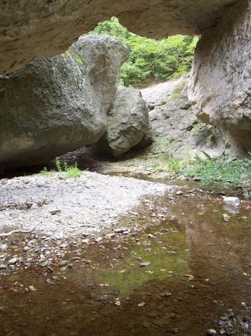
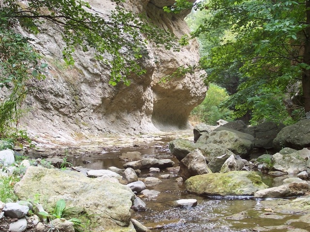
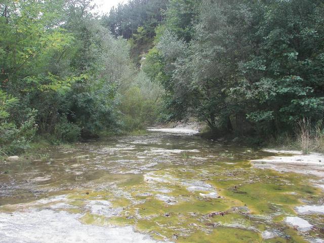
The site is extremely beautiful and attractive for tourists. It is suitable for route tourism with a guide since there is a marked trail but it is very difficult to follow it without someone who knows the area. The trail leading to the Rock window starts from one of the bends of the road near Kardzhali dam which is easily acceccible by a car. The ground up, however, is rough. Therefore it must be visited in the proper time of the year since during the rainy season the water is lush and difficult to overcome. One can reach the natural phenomenon using the main road Haskovo - Kardzhali by deviating at the traffic police checkpoint at the right near the village of Skalna glava. Hiking trail starts from the hut Borovitsa /12 km/.
accomodation
There are several hotels, villas and guest houses, holiday homes and restaurants located in the villages at the bank of the Kardzhali dam and in the town of Kardzhali.
Source: www.kardjali,bg , www.rhodopes-gallery.com
Photos: www.kardjali.bg, http://rhodopes-gallery.com

Chuprene Biosphere Reserve
The reserve is one of the largest biosphere reserves in Bulgaria. It is established in 1973 to preserve the northern coniferous forests of Bulgaria. In 1977 it was included in the list of biosphere reserves under the program "Man and Biosphere".
See on the map
Water Holes Cave
Water Holes Cave is located in Apriltsi Municipality, within the Central Balkan National Park on the northern slope of the massif of Botev Mount.
See on the map
Albotin rock monastery
Albotin monastery is an inactive Medieval rock monastery included in Vidin diocese.
See on the map
Uzana - the geographic center of Bulgaria
Uzana - the heart of the Balkans. In its embrace, the mountains has kept this extraordinary place where you can fully take charge with power and hours to enjoy its grandeur and beauty of nature.Far from the urban vanity you will find abundance of colors and shades, serenity and peace of mind. Here the warbling of the birds and the whisper of wild grasslands will put a spell on you forever.

Chervenitsa - geological phenomena over the village of Kunino
The natural phenomenon Chervenitsa is a molded boulder, rising more than 150 m above the terrace of the river Iskar in village of Kunino. It is located about 46 km east of Vratsa and approximately 120 km northeast of Sofia.
See on the map
The museum of salt
A unique museum in the whole Eastern Europe dedicated to the production of salt by solar evaporation of sea water, Pomorie
See on the map
Lopushanski monastery "Sv. Yoan Predtecha"
The Lopushanski monastery is located in the Balkan Mountain in the valley of Dalgodelska Ogosta river. It is operational and consists of a church, residential and farm buildings and a white stone fountain, all surrounded by a stone wall.
See on the map
Taukliman Reserve
Natural Reserve Taukliman typical landslide with length of about 4 km, formed between the edge of the Dobrudzhansko plateau and the coast.

Basilica Sveta Sofia - Sofia city
The Early Christian basilica Sveta Sofia is an active Orthodox church in the center of Sofia city. The church was probably built in the early VI century on the ruins of early Christian tombs from II - IV century and the ruins of two earlier churches from IV-V century. It is located among the necropolis of the ancient Serdica.
See on the map
Medieval fortress "Monyak"
"Monyak" fortress is one of the largest and high located fortresses in the Rhodopes near the village of Shiroko pole, Kardzhali Region
See on the map
Vakarelski monastery "St Petka"
Vakarelski monastery "St Petka" was found in XX century and now it is working occasionally. It was functioning as nunnery.
See on the map
"The Womb" cave
A unique Thracian temple near the village of Nenkovo, Kardzhali Region
See on the map
Thracian sanctuary "Gluhite kamani"
The megalithic complex "Gluhite kamani" is one of the largest Thracian sanctuaries since BC, whose strength continues to act today to anyone who visits it.
See on the map
Krivus Fortress
A medieval fortress located on a picturesque cliff above Arda River near the village of Bashevo, Kardzhali Region
See on the map
"St. Konstantin and Elena" monastery near Ladzha quarter, Ivaylovgrad
The monastery of Lazdha or Ivaylovrad monastery "St. Konstantin and Elena" is situated close to Ladzha quarter in the town of Ivaylovgrad
See on the map
Rakovitsa monastery Sveta Troitsa
Rakovitsa monastery Sveta Troitsa was was found in X-XI century and during the Middle Ages was an important literary and cultural center in Bdin area.
See on the map
Roman tomb - town of Hisarya
The Hisar tomb is a late Roman family tomb built in the second half of the IV-th century.
See on the map
Elenska basilica
Elenska basilica is early Christian temple that is preserved to nowadays and is situated in proximity to the town of Pirdop
See on the map
"St. Theodor Tyron and Theodor Stratilat" church
A unique monument of culture with extremely precious frescoes and icons included in UNESCO's list with the World Cultural Heritage, village of Dobarsko, Blagoevgrad Region
See on the map
Ovech Fortress
One of the oldest fortresses in Bulgaria located on a high mountain plateau above the town of Provadiya
See on the map