USEFUL INFORMATION ABOUT ALL CITIES, VILLAGES AND RESORTS IN BULGARIA
Settlement:
Town/Village:
- village of Alamovci
- village of Aligovska
- village of Arda
- village of Banite
- village of Barchevo
- village of Barutin
- village of Beden
- village of Bilyanska
- village of Boevo
- village of Bogutevo
- village of Borie
- village of Borika
- village of Borikovo
- village of Borino
- village of Borinovo
- village of Bosilkovo
- village of Bostina
- village of Brashten
- village of Bukata
- village of Bukova polyana
- village of Bukovo
- village of Burevo
- village of Buynovo
- village of Byala reka
- village of Cacarovci
- village of Chala
- village of Chamla
- village of Chavdar
- town of Chepelare
- village of Chepinci
- village of Chereshkite
- village of Chereshovo
- village of Chereshovska reka
- village of Chokmanovo
- village of Chuchur
- village of Churka
- village of Churukovo
- village of Crancha
- village of Dabova
- village of Davidkovo
- town of Devin
- village of Dimanovo
- village of Diralo
- village of Dobreva cheresha
- village of Dolen
- town of Dospat
- village of Dunevo
- village of Dve topoli
- village of Elenka
- village of Elenska
- village of Elhovec
- village of Erma reka
- village of Fatovo
- village of Gabrica
- village of Galabovo
- village of Galishte
- village of Garnati
- village of Gela
- village of Glogino
- village of Gorna arda
- village of Gorovo
- village of Gozdevica
- village of Gradat
- village of Grashtica
- village of Grohotno
- village of Gudevica
- village of Gyovren
- village of Hasovica
- village of Hvoyna
- village of Izgrev
- village of Kasak
- village of Kesten
- village of Kiselichevo
- village of Kokorci
- village of Kokorkovo
- village of Koritata
- village of Koshnica
- village of Kozarka
- village of Kozhari
- village of Krastatica
- village of Kremene
- village of Kundevo
- village of Kupen
- village of Kushla
- village of Kutela
- village of Laka
- village of Leshtak
- village of Levochevo
- village of Lilekovo
- village of Lipec
- village of Lovci
- village of Lyaskovo
- village of Lyubcha
- town of Madan
- village of Maglishta
- village of Malevo
- village of Malka Arda
- village of Marzyan
- village of Mihalkovo
- village of Mitovska
- village of Mochure
- village of Mogilica
- village of Momchilovci
- village of Mugla
- town of Nedelino
- village of Ogled
- village of Ogradna
- village of Orehovo
- village of Oryahovec
- village of Osikovo
- village of Ostrica
- Pamporovo Ski Resort
- village of Pavelsko
- village of Pechinska
- village of Peshtera
- village of Petkovo
- village of Pisanica
- village of Planinsko
- village of Plovdivci
- village of Polkovnik Serafimovo
- village of Polyana
- village of Poprelka
- village of Progled
- village of Ravninata
- village of Ravnishta
- village of Rechani
- village of Reka
- village of Ribnica
- town of Rudozem
- village of Rustan
- village of Sarnino
- village of Selcha
- village of Sharenska
- village of Shiroka laka
- village of Sivino
- village of Slaveyno
- village of Smilyan
- village of Sokolovci
- village of Solishta
- village of Sredec
- village of Srednogorci
- village of Starcevo
- village of Starnica
- village of Stikal
- village of Stomanevo
- village of Stoykite
- village of Strazha
- village of Studenec
- village of Tankoto
- village of Taran
- village of Teshel
- village of Tikale
- village of Trebishte
- village of Trigrad
- village of Turyan
- village of Uhlovica
- village of Valchan
- village of Valchan dol
- village of Varba
- village of Varbina
- village of Varbovo
- village of Varli dol
- village of Varlino
- village of Vehtino
- village of Vievo
- village of Vishnevo
- village of Vitina
- village of Vlahovo
- village of Vodata
- village of Vodni pad
- village of Voykova laka
- village of Yagodina
- village of Zabardo
- village of Zaevite
- village of Zagrazhden
- village of Zhrebevo
- town of Zlatograd
- village of Zmeica
- village of Zmievo
- village of Zornica
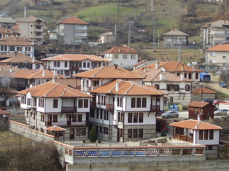
town of Zlatograd
See it on the map Bulgarian properties in Smolyan Region - Zlatograd
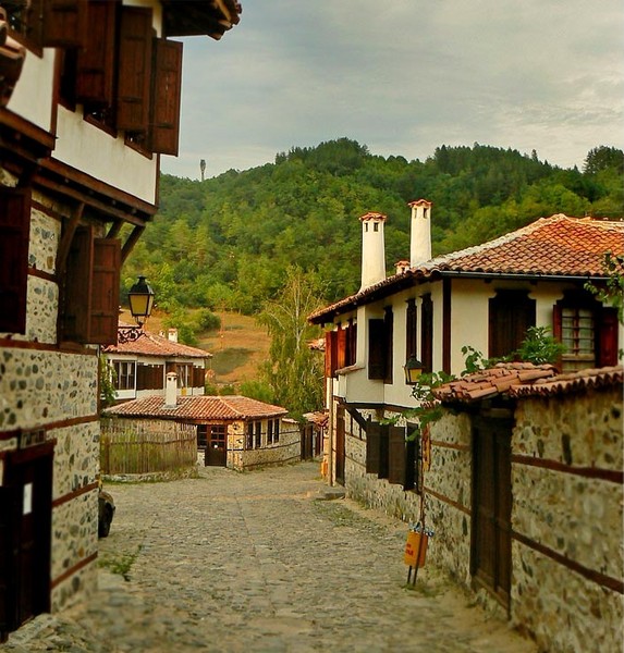
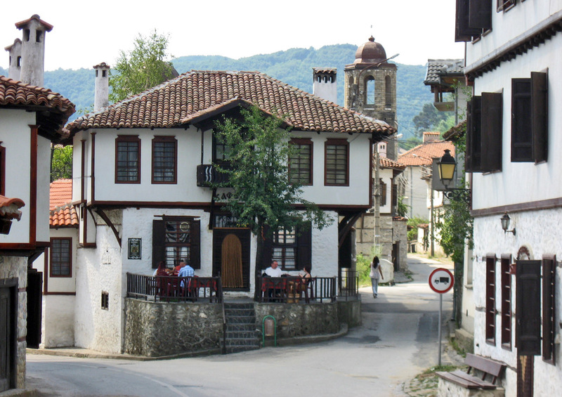
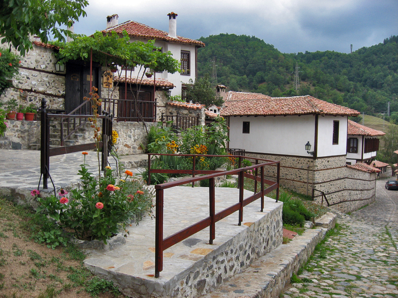
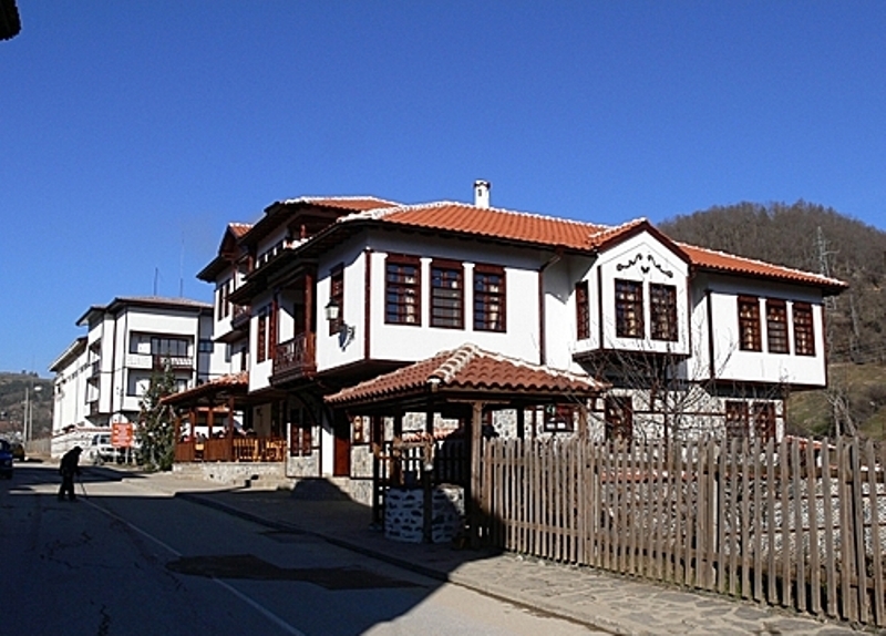
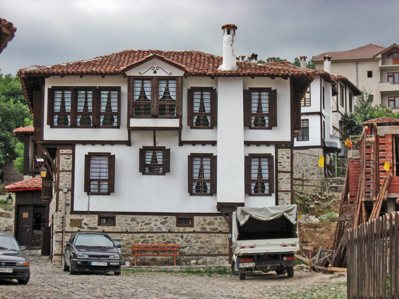
Zlatograd ( literally Gold town) is a town in Bulgaria, 60 km from Smolyan. It is located in a valley between the eastern and central massif of the Rhodope mountains. The Greek border lies just 5 km away from the town. She was a township of the Ottoman Gümülcine sanjak in Edirne vilayet between 1867 and 1912. It was known in Ottoman Turkish as Darıdere.The history says that, Zlatograd was created from sick people sent away from Startsevo.
Administrative location: Zlatograd municipality is spread on a territory of 175.8 km². It has common borders with the municipalities of Kirkovo and Dzhebel (to the east), Nedelino (to the north), Madan and Rudozem (to the west) and with the Republic of Greece (to the south) - on the borderline between Bulgaria and Greece).
Climate: The municipality is included in the transient-Mediterranean climate region.
Mineral resources: lead-zinc ore;
Water resources:: The territory of the municipality is crossed by Varbitza river which is 98.1 km long and its catchment basin is 1202.8 km. Nedelinska and Kushlenska rivers are tributaries of Varbitza. There is a dam lake called "Zlatograd" with water capacity of 4,4.106 m . and a micro dam lake called "Hasidere" (0,4.106 m).
Soils: maroon forest leached (97.59 km²); brown forest-dark (12 km²); brown forest-transient (83.37 km²); brown forest light (117.59 km²); alluvial-delluvial (0.59 km²); humus-carbonate (11.07 km²);
Forest Fund: It covers an area of 144.60 km². The following species like beech, hornbeam, oak, birch and cornel-tree are mostly spread among the broad-leaved forests. Prevailing coniferous trees are spruce, fir-tree, white and black pine.
Environment: There is a tailings pond called "Erma Reka" which is 8 km away from the town of Zlatograd and 5 km away from the village of Erma Reka. The municipality is rich in underground resources. In the surroundings of Erma Reka there is a geothermal deposit of hot mineral water.
Population and settlements: The total number of population is 14,874 (7,285 males and 7,589 females) citizens, most of them living in the town of Zlatograd (8,444) and the villages of Starcevo and Erma reka (the total number of village population is 6,430). The municipality comprises Zlatograd and 9 more settlements.
Labour force and unemployment: The rate of unemployment is 32.64 %, which is the highest since 1990. The active population is 8,063 citizens of whom 50,97 % are employed in the public sector and 49.03 % in the private sector.
Agricultural Fund: It covers 25 km² and the arable land is 12 km². The cultures grown in the municipality are tobacco, potatoes, vegetables and strawberries (representatives of perennial plants).